
AERIAL
SURVEY
(Drone Supported)
VIRTUAL SITE IS AN DRONE AERIAL SURVEY COMPANY SUPPORTING LAND SURVEYORS / MINING INDUSTRY.
Doug Moon, PE
Certified UAS PILOT
Professional Engineer


Michael Detwiler, CP
ASPRS Certified Photogrammetrist
Photogrammetric
Surveyor
Doug’s Story
Imagine seeing someone’s vision through their eyes without interpretation.
This concept has driven my career path since the mid 90s. In early 2000, I had trained and integrated my first group of Cad support staff into the 3d world. This is pretty amazing when you think it was just last month I heard, “The jury is still out on whether designing in 3d is worth it”. Well, not only can I tell you that it is “worth it”, but I can also say a lot of advancement has happened over the last twenty years while the jury was debating. As a professional or the client, you can relate to the communication gap the exists between the imaginary 3d model living in one’s head to the highlighter marks of another.
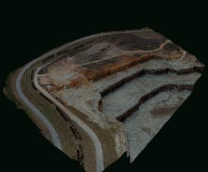
Virtual Site was created in 2003 to help bridge this communication gap. Luckily, I had no idea how long it was going to take to bring it all together. Technology has now advanced to the point of gathering photo-realistic 3d models and developing real world land topography maps for design through the use of drone technology. This isn’t a future concept, this is today’s technology in use by professionals like myself and Michael, who you will soon meet. Our expertise allows Virtual Site to certify data through national standards instead of relying on manufacturers claims. We deliver data you can trust!
Michael’s Story
Michael was the perfect fit for Virtual Site and he became a business partner in 2019. His role as a Managing Member and Director of Photogrammetric Surveying gave our Aerial Survey Company the Professional expertise needed to provide clients with Certifiable Survey level Accuracy.
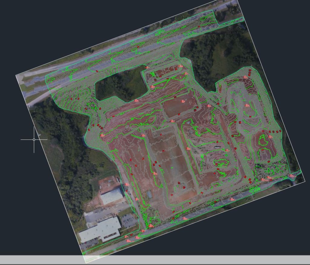
Certified nationally by the American Society of Photogrammetry & Remote Sensing, Michael has worked in 30 different states and 12 different countries. His expertise includes the processing, analysis, and accurate calibration of aerial captured data. Project experience includes LIDAR mapping of powerlines, quarries and open pit mines as well as general topography for land development projects.
Michael’s land survey experience as an LSIT along with his photogrammetry background qualified him to take the test to become a certified Professional Photogrammetric Surveyor developed by the Colonial States Board of Land Surveyors. Virtual Site is proud to announce that Michael not only qualified to take the test but is the first person to receive this professional certification in the State of South Carolina through formal testing methods.
Michael is excited to combine his expertise to deliver clients Certifiable Topographic Surveys using the latest drone technologies.
SERVICE AREA
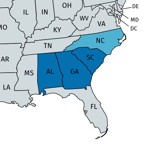
Based out of Greenville, SC
(864)810-0811
Currently Serving: SC, GA (NC & AL coming soon)
Mailing Address:
Virtual Site, llc
PO BOX 25192
Greenville, SC 29616