
Virtual Site
Aerial Solutions
(864)810-0811
Virtual Site produces Aerial Surveys from Drone Data developed by licensed professionals!
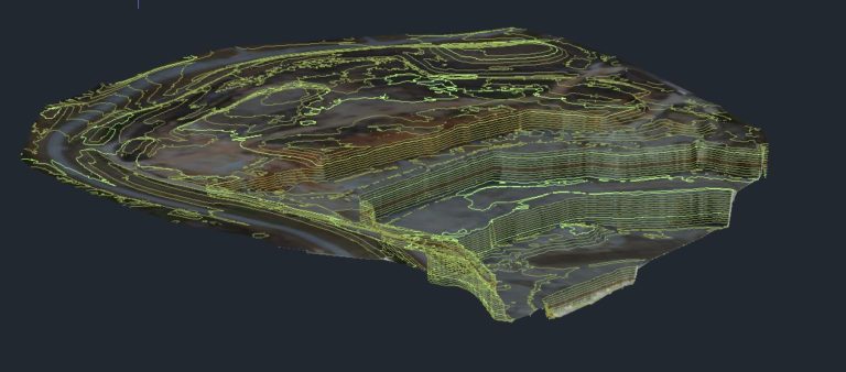
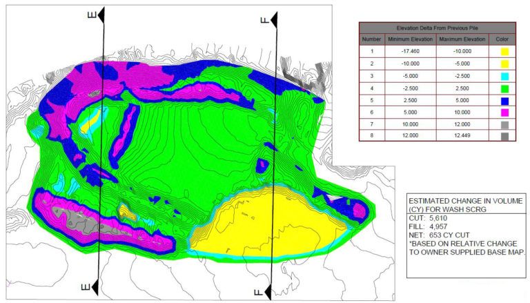
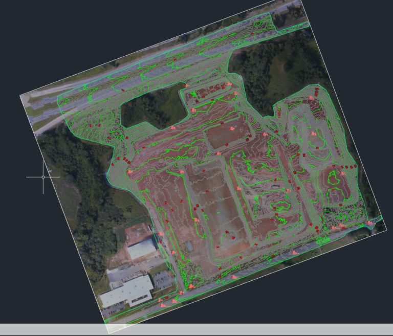
Topographic Aerial Surveys are certified to local and national standards by our photogrammetrist.
Ground Control is set by a Registered Professional Surveyors licensed in the State.
Our FAA certified drone pilot is also MSHA Part 46 certified to accommodate the Mining Industry needs for open pit quarry mines and stockpile inventory management.
Data is acquired by our drones and processed in house, not by a third party. This not only saves time and costs but allows our professionals to monitor and process the data directly.
Virtual Site is an Aerial Survey Company that delivers Aerial Surveys and Aerial Imagery you can trust!